
Sale!

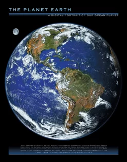
The Living Earth From Space Poster
Original price was: $20.79.$14.55Current price is: $14.55.
- Experience the Best Quality
- Shop with Confidence, Pay Safely
- Shop quality, shop with us.
- The quality solution for all your needs.

Product Details
Earth comes alive in this panoramic map! See terrain features, prominent landmarks and the natural beauty of our world with this topographical satellite image. The image was taken from a remote sensing satellite, processed and computer-enhanced from digital data to create the layout shown. Each of the four hemispheres are shown in the lower region of the map. Size: 36″ × 24″; glossy paper.
Be the first to review “The Living Earth From Space Poster”
Related products
Sale!


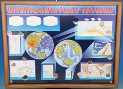
Earth & Environmental Science
Original price was: $56.82.$39.77Current price is: $39.77.
Sale!
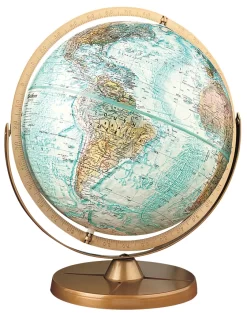
Earth & Environmental Science
Original price was: $78.95.$55.27Current price is: $55.27.
Sale!
Earth & Environmental Science
Original price was: $97.89.$68.52Current price is: $68.52.
Sale!
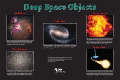
Astronomy
Original price was: $13.77.$9.64Current price is: $9.64.
Sale!


Air Testing
Original price was: $64.55.$45.19Current price is: $45.19.
Sale!


Earth & Environmental Science
Original price was: $72.90.$51.03Current price is: $51.03.
Sale!
Astronomy
Original price was: $14.23.$9.96Current price is: $9.96.
Sale!

Earth & Environmental Science
Original price was: $64.06.$44.84Current price is: $44.84.
Reviews
There are no reviews yet.